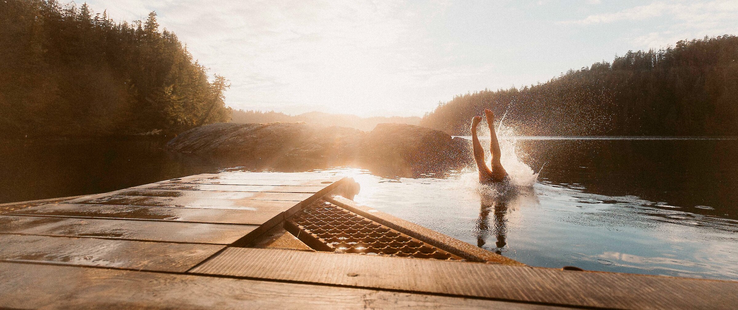
It is predicted that air temperatures will rise by 1.4-3.9°C during the 21st century in this part of British Columbia, consequently increasing ocean and fresh water temperatures.
Photograph by Gleb Raygorodetsky

Like other indigenous First Nation communities throughout Canada, the Tla-o-qui-aht peopleare survivors. Over a century of cultural genocide, Christianisation, forced assimilation, land alienation and re-settlement reduced their numbers tenfold and pushed them to the brink of extinction. But despite environmental, social and cultural upheavals, the Tla-o-qui-aht are slowly but surely strengthening their ability to cope with social and environmental challenges, including climate change.

Last week, in Chapter 1 “Survivors” of this six-part series, Adjunct Research Fellow Gleb Raygorodetsky of the United Nations University Traditional Knowledge Initiative arrived in Ha’huulthii — the traditional territory of the Tla-o-qui-aht that is widely known as Clayoquot Sound, British Columbia. He encapsulates the recent past and sets about visiting with the local people who will help us understand the challenges and triumphs the Tla-o-qui-aht people have faced. In this second chapter, master carver Joe Martin begins showing Raygorodetsky some of the most significant places in Ha’huulthii

• ♦ •

Chapter 2: Enchanted Echachist [pronounced i-CHA-chist]

At first, there is nothing. Just shades of gray. The grayness brightens in places only to dim moments later. Some lighter patches rise and merge, darker ones swirl and fade. They are enveloping and saturating, seeping into every pore of my exposed flesh. I glance down at my hands clenching the side of the boat. They appear solid, but feel cold and damp, and look drained of color.

Ahead, a darker shape precipitates out of this gray soup. With no reference points, it is hard to judge the scale – is it a smudge on my eyeglasses or an enormous mass looming ahead? The put-put-putting of the 90-horse outboard motor is almost inaudible in the thick fog as our 20-foot fiberglass fishing boat rides the glassy swell toward the obscure form ahead.

Islands of Clayoquot Sound are reluctant to get out from under the cover of morning fog. But later in the day, the summer sun often burns through the mist, and the light throws land- and seascape into sharp, vibrant relief.
Photograph by Gleb Raygorodetsky.

Echachist!” Joe Martin announces behind me, his voice muffled by the thick fog, as the shadow condenses into the recognizable shape of an island. I hear Enchanted! instead. Suspended above the ocean—like Laputa, the flying island of Myazaki’s “Castle in the Sky”—Echachist is swaddled in the rolling waves of dense morning mist. The fog has enveloped us since early this morning when Joe first pushed his boat away from a dock in Tofino—a nature lovers’ mecca.

The town’s small resident population swells tenfold as the whale watchers and anglers, surfers and bird watchers, kayakers and storm trackers flock here throughout the year from around the world. Like a kid lingering in bed, pulling the quilt over her head when it’s time to rise and get ready for school, Tofino is always reluctant to get out from under the cover of morning fog. But later in the day, the summer sun often burns through the mist, and the light throws land- and seascape into sharp, vibrant relief. Joe is certainly counting on that today.

From under a full head of thick black hair with only a few streaks of white at his temples, Joe’s penetrating dark eyes quickly scan the distance between the boat and the emerging coastline. Standing behind the navigation console, his sinewy frame wrapped in a bright red flotation jacket, Joe slowly turns the boat’s wheel, cautiously guiding the vessel around large rafts of bull kelp toward the island, its craggy coastline now in full view. In a few minutes we reach a rocky point on the island’s southeastern shore that forms a natural breakwater, sheltering a sandy beach on the opposite side.

Several feet from the rocks, Joe kills the motor and nimbly runs to the front of the boat to grab a mooring buoy bobbing on the surface among the bladders of the bull kelp. With few slashes of his fishing knife, he clears a patch around the boat from the kelp’s large blades and stipes, or stems, to make it easier to secure the boat to the mooring line with a few deft knots. Joe jumps onto the rocks and holds the boat for me to climb out. “Welcome to Echachist, the home of Tla-o-qui-aht people,” he says and then adds grinning, “And my home!” Where Echachist’s ancient forest reaches the beach, stands a house that Joe built over 20 years ago.

Joe Martin jumps onto the rocks and holds the boat for me to climb out. “Welcome to Echachist, the home of Tla-o-qui-aht people,” he says and then adds grinning, “And my home!”
Photograph by Gleb Raygorodetsky.

It is the middle of July now, the peak of tourism season, and Vancouver Island is on its way to breaking a record of consecutive days without rain, one of many signs that the weather and climate are drifting away from their historical norms. Air temperatures are predicted to rise by 1.4-3.9°C during the 21st century in this part of British Columbia, consequently increasing ocean and fresh water temperatures.

According to the Ecotrust Canada’s report “Climate Change Adaptation in Clayoquot Sound,” the summers on the Island are predicted to be drier, while winters will see more rain but less snow. Less summer rain will make fresh water a precious commodity here during the warm months, even though it is one of the wettest places in North America. And the winter storms will continue to get stronger, pummeling the Clayoquot coast more often, as the sea level continues to inch up the shoreline, eating it away.

I want to understand what these new transformations mean to the Tla-o-qui-aht people in the context of past changes they have experienced—from abrupt social shakeups, like assimilation into industrial society and epidemics; environmental changes, such as deforestation and overfishing; and significant climactic shifts, like warming air and water, and sea level rise.

Over the next few days, I hope to learn from Joe and his Tla-o-qui-aht relatives and friends, like his nephew and the Tribal Parks Co-Director, Eli Enns, and a Tribal Parks Guardian, Cory Charlie, how they are navigating this new set of challenges not of their own making. But to even begin a conversation about the new challenges, I first need to reacquaint myself with the place and the people. So, today, Joe is taking me to some of the most significant places in Tla-o-qui-aht people’s territory around the Sound.

Coastal temperate rainforests, like those of Clayoquot Sound, are as breathtaking as they are unique. Covering less than one percent of the planet’s land surface along the coasts of western North America, New Zealand, Tasmania, Chile, and Argentina, these forests are rare and getting more so, as the timber industry continues to log the old growth woods, even though at reduced rates. A 60-mile stretch of Vancouver Island’s west coast is one of the few remaining places on Earth where such rainforests endure.

The giant western hemlocksDouglas firswestern red cedarsSitka spruce are some of the Earth’s most ancient living beings. Over a thousand years old and reaching 300 feet tall and 60 feet in girth, these giants have stood witness to the region’s history, both ancient and modern, geological and ecological, natural and human. The very presence of the old-growth rainforests here along the coast signifies that fundamental shifts in the Earth’s environment had taken place, for the trees could only take root when the glaciers and the sea had retreated as the climate had warmed.

A 60-mile stretch of Vancouver Island’s west coast is one of the few remaining places on Earth where coastal temperate rainforests endure. The giant western hemlocks, Douglas firs, western red cedars and Sitka spruce are some of the Earth’s most ancient living beings. Over a thousand years old and reaching 300 feet tall and 60 feet in girth, these giants have stood witness to the region’s history, both ancient and modern, geological and ecological, natural and human.
Photograph by Gleb Raygorodetsky.

In geological, and even human, terms the climate and forests of Vancouver Island we know today are fairly young. The millennia of glacial advances and retreats between 29,000 and 15,000 years ago carved out the 865,000 acres of watershed that drains into the Sound. When glaciers finally retreated around 15,000 years ago, the climate became colder and drier compared to today.

A warming period between 12,000 and 11,000 years ago allowed Douglas fir to take hold and expand, but about 8,000 years ago, the onset of a wetter and cooler climate helped western red cedar thrive and the entire ecosystem gradually transformed into the coastal temperate forests of our time. The Clayoquot Sound shoreline dropped from about 100 feet to 10 feet above today’s sea level, between 13,000 and 7,000 years ago. After remaining unchanged for a thousand years, the sea then continued to recede to its present levels.

With the glaciers’ retreat, the coastal waters, the land, and its forests became home to a rich diversity of life forms. The warm North Pacific Current brings moist air to the western shores of Vancouver Island, but the rising slopes of the steep coastal mountains check the eastward progress of the ocean and air flows. Having used up every iota of energy carrying its burden of moisture this far, the air spills the rain and snow over the large tracts of coastal rainforest. Sometimes it rains as much as 120 inches a year here, which is why it is considered one of the wettest spots in North America.

The lakes, bogs, and aquifers absorb this deluge, while the countless rivulets, rills, streams, and rivers bring it back to the ocean. In the estuaries dotted with numerous rocky skerries, or small islands, the sediment carried by the water from the forested mountain slopes settles into mudflats. The sea and forests, streams and mountains, fjords and mudflats – all form the rich matrix creating abundant and diverse habitats that shelter and nourish a wide variety of local and migratory species.

In the estuaries dotted with numerous rocky skerries, or small islands, the sediment carried by the water from the forested mountain slopes settles into mudflats. The sea and forests, streams and mountains, fjords and mudflats of Clayoquot Sound – all form the rich matrix creating abundant and diverse habitats that shelter and nourish a wide variety of local and migratory species.
Photograph by Gleb Raygorodetsky.

Dungeness crabs scour the shallows in search of clams with such exotic names as Manila, Butter, Varnish and Razor. En route from South America to the Arctic, flocks of Western sandpipers make a stopover at the Tofino mudflats to feast on the profusion of worms and other invertebrates. Herring converge on beds of seagrass along the shores to spawn, their eggs and milt mixed with seawater attracting thousands of birds, whales, and seals.

Cruising along the coast, gray whales dive to the bottom of shallow bays to gulp up the sediment teaming with mud-dwelling clams, ghost shrimp, and marine worms, which they filter out through the baleen plates suspended from their palates. Black and brown bears feast on salmon spawning in the streams and forage on salal, thimble, huckle and salmon berries abundant in the forest understory. Roaming the mountains and coasts are wolves and cougars in search of black-tailed deer and Roosevelt elk that thrive on the variety of grasses and nutritious lichens flourishing throughout the old-growth forest.

But it is the Pacific Salmon that is the lifeblood of the Clayoquot ecosystem, weaving the land and sea together as its life unfolds. Every summer, after spending up to four years in the open ocean and travelling for nearly 9,000 miles away from their nursery streams, salmon return to their birthplace, following scents and waypoints known only to them. The fish brave the rapids and waterfalls on the way to their spawning grounds—gravel bottoms of creeks and springs, where they lay their eggs.

Along the way, their bodies—battered and scarred by obstacles and predators—change. They transform into ancient warriors wearing the war colors of their distinct tribes – red Sockeyes, purple Chums, and rosy Pinks. Though their fearsome headgear of hooked jaws and protruding teeth may be effective at keeping their own kin at bay as they battle for spawning partners, it fails to repel other foes, such as eagles, bears, and men.

Tofino’s small resident population swells tenfold as the whale watchers and anglers, surfers and bird watchers, kayakers and storm trackers flock here throughout the year from around the world.
Photograph by Gleb Raygorodetsky.

Over 190 different species of plants and animals—from killer whales to giant cedars, from insects to lichens, from loons to bears—depend on the yearly arrival of this remarkable constellation of Pacific salmonids. By dragging the still thrashing fish or the carcasses of spawned-out, dead salmon into the brush, predators transport precious nutrients, particularly marine nitrogen, into the riparian ecosystem. In large watersheds, where bears are common,the marine nitrogen “signature” of salmon can be found in plants growing as far as 2,500 feet away from the stream. But even in small watersheds, plants 500 feet from the water are also “made of salmon”, or of its constituent nutrients dispersed by predators and scavengers throughout the area and absorbed by the plant cells.

Such an intricate entanglement of life’s vital elements creates inalienable relationships between the open ocean and the old growth forest. After fattening for years in the open ocean on herring, pelagic amphipods, and krill, the salmon return to the fresh water streams to spawn and die. They bring back with them precious nutrients to nourish the old growth forests that provide cool, shaded waterways with ideal conditions for salmon eggs, as well as for fry, the fresh-water life stage of salmon, that mature into smolt, the life stage that heads out into the open ocean.

Over millennia, this vibrant web of relationships has also supported human societies as rich and diverse as the ecosystems on which they depended. According to their lore, Nuu-chah-nulth people, whom European traders and settlers called Nootka, have thrived all along the western shores of Vancouver Island since time immemorial. Nobody knows for sure, but it is estimated that before the smallpox epidemics introduced by European settlers decimated the region’s communities in mid-1800s, the nine Nuu-chah-nulth groups living around the Clayoquot Sound numbered around 10,000 people. Today, fewer than a thousand remain.

For thousands of years, flora and fauna of ocean and land – whales and salmon, halibut and berries, herring and ducks, clams and springbank clover – shaped life for the Tla-o-qui-aht people. Echachist used to be a major seasonal hub for Tla-o-qui-aht whaling and fishing.

Before the arrival of Europeans, it was a thriving center of Tla-o-qui-aht culture, serving as a major summer seat of the leading Chief Wickaninnish. The Island’s location at the mouth of the Clayoquot Sound where it meets the Pacific made it an ideal site to launch whaling canoes. The Island’s even gravel beaches were also well suited for the landing of harpooned whales—gray, right, or humpback—as thousands of animals migrated past Echachist every year.

Countless mussel shells, crusted-over with sea salt and bleached by the sun, crunch under my feet.
Photograph by Gleb Raygorodetsky.

As I follow Joe to his house, I stumble, my feet sliding on rocks slippery with algae exposed by the receding tide. At 60, Joe moves up the steep rocky beach with the agility and surefootedness of a young man who knows every pebble on this land. The faded one-story building at the edge of the forest overlooking the landing has a wide unfenced deck under a big window facing the beach and the ocean.

Sun-bleached mussel shells, skulls, bones, and unusually colored and shaped pebbles decorate the top of a low bench and a couple of small rickety tables under the window. We step inside, where the gray light, struggling to break through the fog, seeps into the cabin through the window, creating a framed image, like a vintage photograph, of Echachist’s coastline. Joe’s spartan house is spacious but sparsely furnished. There is a couple of old chairs and a table in the middle of the room. By the window, there is a bed and several shelves packed with worn books, stacks of papers, carvings, and a medley of souvenirs from his various voyages.

“In the old days, our people would spend several weeks living on the island during the spring season,” Joe explains. From a nail in the wall he lifts a hand-size hook made of hard wood. “This is a traditional halibut hook I made from the base of a spruce branch. I didn’t quite finish it, because the wood had a weak point, but it’s good enough to show you how we used to catch halibut.”

Holding one end of the wooden hook in his left hand, Joe places his right index finger across it to indicate where the missing barb and the bait would go. “It’s not too far from here to paddle out in a canoe to the halibut fishing spot,” Joe explains. “They’d bait the hooks with octopus caught on the reefs, and paddle out to set them on the ocean floor for halibut. We still go fishing in the same spot, but there are much less halibut nowadays and the fish are a lot smaller.”

“This is a traditional halibut hook I made from the base of a spruce branch,” Joe Martin explains. “I didn’t quite finish it, because the wood had a weak point, but it’s good enough to show you how we used to catch halibut.” The hooks were baited with octopus caught on the reefs, and set on the ocean floor for halibut.
Photograph by Gleb Raygorodetsky.

Joe rummages through stacks of old papers on the shelf and pulls out a faded archival photograph. Wrapped in traditional bearskin blanket, a Nuu-chah-nulth whaler stands on the beach. A pair of sealskin bladders is hoisted on his shoulders, tethered with a coiled leather thong to the whaling harpoon he is holding in his other hand. “In the old days, our people mostly preferred to hunt for humpback whales,” Joe says with a hint of nostalgia in his voice. “But there were other whales that were taken as well, like the finback, which is the second largest whale in the world, and the right whale, which used to be here. The gray whale, the minke whale, and the sperm whale were also taken. Large whaling canoes were used to go after them.”

I follow Joe out of the house and we walk to the opposite side of the beach. Countless mussel shells, crusted-over with sea salt and bleached by the sun, crunch under my feet. Joe stops at an opening to a wide channel leading through the rocks from the beach all the way to the open water. Large boulders piled up high on both sides signify the hard work Joe’s ancestors put into making it easier to beach harpooned whales centuries ago. The whales were butchered right on the shore, and the meat was cut up, smoke-dried for the winter, and the blubber rendered into oil.

Many whalebones were left behind in ever-growing heaps. Joe points toward a grass-covered knoll about 15 feet tall and 150 feet long at the edge of the forest, “This is one of the spots where the bones were left,” he says. “In fact there’s this fella I’m supposed to meet here in the next few days — Dr. Jim Darling. He’s a whale biologist living here in Tofino. We’re supposed to make a plan about where to begin digging for whalebones. Basically, the wants to be able to tell what kind of whale, how long ago it was, and also to see perhaps even what kind of a diet that whale had. For us, the general idea is to interest our own youth, so that they learn about our traditional territory and our way of life. Especially, about the history of whaling, which used to be so important to our people, but had to be abandoned because of what commercial whaling did to the whales.”

Commercial whaling came to the Pacific Northwest in mid-1800s, and, in less than a century, unleashed the same devastation on the migratory populations of whales that the fur trade had inflicted upon the furbearers a few decades earlier. Between 1905 and 1967, when commercial whaling was finally banned, whaling stations along the west coast of Vancouver Island alone, killed and processed a total of over 24,800 fin, sperm, gray, humpback, and blue whales. The collapse in numbers of whales passing through Tla-o-qui-aht traditional territory during the first half of the 20th century, made it increasingly difficult for Tla-o-qui-aht people to continue their annual subsistence cycle. As the whaling on Echachist came to an end, the island ceased to be a seasonal hub for Tla-o-qui-aht hunting and fishing. Joe’s house is the only permanent Tla-o-qui-aht dwelling remaining.

Bull kelp’s bladders, blades and stipes, or stems, at low tide along the shoreline of Echachist Island.
Photograph by Gleb Raygorodetsky.

Tla-o-qui-aht whaling technology was not primitive, but quite lethal. A thirty to forty-foot ocean-going whaling canoe made of a single cedar log and manned by an eight-person crew allowed for quick pursuit of the migrating giants. The whaling crew consisted of six paddlers sitting side by side, a steersman in the back, and the harpooner in the front of the boat. The harpooner captained the canoe, directing the hunt based on his knowledge of whale behavior and his ability to read the subtle signs to predict its movements.

In the hands of a master harpooner, an eighteen-foot long spear—its head hewn out of two interlocking pieces of hard yew and tipped with a sharp mussel shell glued into the shaft with rock-solid spruce sap—presented a formidable weapon capable of making a significant dent in the numbers of whales migrating past Echachist. Still, despite this advanced technology, the Tla-o-qui-aht people managed to harvest whales for centuries without diminishing their numbers.

Each Tla-o-qui-aht house, or clan, followed a set of traditional, time-tested rules governing their relationship with the entire Ha’huulthii, their traditional territory, including how many whales they could take during the annual whale hunt. “I come from the house of Eewas,” Joe states proudly, “which means a ‘wide land’. We were allowed to take ten whales every year.” Joe looks at me to see my reaction.

With close to ten thousand Tla-o-qui-aht people living around the Clayoquot Sound at the time, I can imagine the whale harvest to be quite high. “Still,” Joe pauses here to emphasize the point, “They would never kill more than what they needed to provide for themselves, and, every year, they had whales to hunt. One of our teachings is that Mother Nature will provide for our needs, but not our greed. And it’s the greed that’s overriding a lot of things nowadays.”

We continue for a few minutes along the beach, climbing over rocks to the edge of an open grotto the size of a small swimming pool. The tide is beginning to come in, but there is still enough room for the waves to take a quick run across the cavern and slam with a timpani-like BOOM! against the underside of a low ledge. For Tla-o-qui-aht, as for other Nuu-chah-nulth tribes, whaling was not just a matter of subsistence, but it was a culturally and spiritually significant activity.

“Our whale hunters would come here to dive and prepare themselves for the hunt,” says Joe, his bronzed hand reaching toward the pool. “With the waves moving in and out like this, it kept them in practice so that they would never, ever be afraid of the water. They would come here and do this ritual the night before the hunt or early the morning, just before leaving.” We stand by the pool for a few minutes, listening to the pulse of the Clayoquot.

“Well, the fog’s lifting,” Joe finally says, pulling himself away from this window into his people’s past. “Now’s a good time to visit Meares Island—it will be a nice ride.” As the last wisps of fog dissipate, Clayoquot Sound around us bursts forth in brilliant hues – the deep malachite of forests, the almost translucent whalebone of the distant mountain peaks with puffy clouds floating above the deep sapphire of the ocean and the Sound.

Called Wah-nah-jus Hilth-hoo-iss in Nuu-chah-nulth, Meares Island is the place where Tla-o-qui-aht people would traditionally spend their winters hunting, socializing, and holding important coming-of-age ceremonies, like the rites of passage into the wolf clan.

The ancient temperate rainforests bear tree scars left by Tla-o-qui-aht ancestors who peeled off the bark for their baskets, and carved out boards, for canoes and long houses, harvesting the trees without killing them. Today, such ancients are known as Culturally Modified Trees, or CMTs.
Photograph by Gleb Raygorodetsky.

The ancient temperate rainforests covering Meares Island bear witness to long-time human presence, like the tree scars left by Tla-o-qui-aht ancestors who peeled off the bark for their baskets, and carved out boards, for canoes and long houses, harvesting the trees without killing them. Over centuries, these scars healed, leaving a permanent record of people’s past use of the area. Today, such ancients are known as Culturally Modified Trees, or CMTs.

The markings in other parts of Clayoquot Sound rainforests are more recent, and much less benign—they are the scabs of clear-cuts left by the logging industry during recent decades, still healing on the mountain slopes and valleys around Clayoquot. These wounds would be much more extensive and threatening to life here, had it not been for the unwavering resolve of the Tla-o-qui-aht people who took a firm stand against the logging industry in 1980s and again in 1993, during one of the largest, peaceful, civil protests in Canada’s history against clear-cutting of old growth forests.

Please visit NewsWatch again next week for the next story in The Tla-o-qui-aht People and Climate Change series.

• ♦ •

This article is part of the Healing the Earth project of the Conversations with the Earth (CWE) initiative, a multimedia platform that brings indigenous voices on climate change to the global audience. It is supported by Land is Life. Follow CWE on Facebook or Twitter @ConversEarth.